


-

Replica of the original Lehi Schoolbuilt in 1880 (MHP).
-

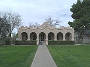
Sirrine House, built in 1896 (NRHP) Historic Significance: Architecture/Engineering, Architect, builder, or engineer: Sirrine, Joel E., Architectural Style: Queen Anne, Area of Significance: Architecture, Period of Significance: 1900–1924, 1875–1899.
-
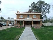
Angulo-Hostetter House, built in 1902 (NRHP) Historic Significance: Architecture/Engineering, Architectural Style: Colonial Revival, Queen Anne, Area of Significance: Architecture, Period of Significance: 1925–1949, 1900–1924.
-
Strauch-Fuller House, built in 1906 (NRHP) Historic Significance: Architecture/Engineering, Architect, builder, or engineer: Unknown, Architectural Style: Mission/Spanish Revival, Area of Significance: Architecture, Period of Significance: 1900–1924.
-

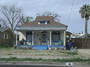
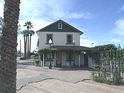
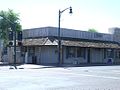
The Robert Scott House was built in 1909 and is located at 2230 E. Grandview St. in Mesa. The residence belonged to Robert Scott, a wealthy Mesa sheep farmer and large landowner, who was a co-founder of the Salt River Bank. The Scott House originally stood within the original Mesa townsite on the corner of First and Sirrine Streets, and when completed was among the few large formal residences in Mesa. Commercial expansion and downtown redevelopment projects during the past twenty years have changed the character of the townsite area. The original site of the Scott House was sold for commercial development in 1972, and the house was subsequently moved six miles to a residential subdivision where it is now located. The property was listed in the National Register of Historic Places on July 8, 1982, reference #82002079.
-
Lehi School, built in 1913 (NRHP) Historic Significance: Architecture/Engineering, Event, Architect, builder, or engineer: WPA, Architectural Style: Moderne, Mission/Spanish Revival, Area of Significance: Architecture, Community Planning And Development, Entertainment/Recreation, Education. Period of Significance: 1950–1974, 1925–1949, 1900–1924.
-
Spangler-Wilbur House, built in 1915, (NRHP) Historic Significance: Architecture/Engineering, Architect, builder, or engineer: Home Builders Inc., Architectural Style: Colonial Revival, Mission/Spanish Revival, Area of Significance: Architecture, Period of Significance: 1900–1924.
-
James A. Macdonald House, built in 1916–1918 (MHP).
-
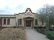
Dr. Lucius Charles Aston House, built in 1920 (NRHP). The Dr. Lucius Charles Alston House is associated with the history of the development of the African American community in Mesa. The house served as Dr. Alston's office while practicing medicine in Mesa.
-
Tempe
Info from https://en.wikipedia.org/wiki/Tempe,_Arizona
Tempe (/t?m?pi?/ tem-PEE';[4] Oidba? in O'odham), also known as Hayden's Ferry during the territorial times of Arizona, is a city in Maricopa County, Arizona, United States, with the Census Bureau reporting a 2017 population of 185,038.[3] The city is named after the Vale of Tempe in Greece. Tempe is located in the East Valley section of metropolitan Phoenix; it is bordered by Phoenix and Guadalupe on the west, Scottsdale on the north, Chandler on the south, and Mesa on the east. Tempe is also the location of the main campus of Arizona State University.
Tempe, ArizonaCity of Tempe 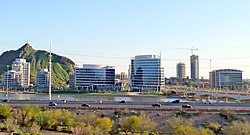

Flag Location of Tempe in Maricopa County, Arizona.
 Tempe, ArizonaLocation in the United States
Coordinates: 33°24′46″N 111°56′35″WCoordinates: 33°24′46″N 111°56′35″W Country United States State Arizona County Maricopa Incorporated October 15, 1892 Government • Mayor Mark Mitchell (D) Area • City 40.23 sq mi (104.18 km2) • Land 39.97 sq mi (103.51 km2) • Water 0.26 sq mi (0.67 km2) Elevation 1,140–1,495 ft (347.47 – 455.68 m) Population • City 161,719 • Estimate (2016)[3]185,038 • Rank US: 133rd • Density 4,566.33/sq mi (1,763.08/km2) • Metro 4,574,531 (US: 12th) Time zone UTC−7 (MST (no DST)) ZIP code 85281, 85282, 85283, 85284, 85285, 85287Area codes 480 and 602 FIPS code 04-73000 Website www.tempe.gov Tempe (/t?m?pi?/ tem-PEE';[4] Oidba? in O'odham), also known as Hayden's Ferry during the territorial times of Arizona, is a city in Maricopa County, Arizona, United States, with the Census Bureau reporting a 2017 population of 185,038.[3] The city is named after the Vale of Tempe in Greece. Tempe is located in the East Valley section of metropolitan Phoenix; it is bordered by Phoenix and Guadalupe on the west, Scottsdale on the north, Chandler on the south, and Mesa on the east. Tempe is also the location of the main campus of Arizona State University.
Contents
History[edit]
 Tempe between 1870 and 1880.
The Hohokam lived in this area and built canals to support their agriculture. They abandoned their settlements during the 15th century, with a few individuals and families remaining nearby.
Fort McDowell was established approximately 25 mi (40 km) northeast of present downtown Tempe on the upper Salt River in 1865 allowing for new towns to be built farther down the Salt River. US military service members and Hispanic workers were hired to grow food and animal feed to supply the fort, and less than a year later, had set up small camps near the river that were the first permanent communities in the Valley after the fall of the Hohokam. (Phoenix was settled shortly afterward, by 1867–68.) The two settlements were 'Hayden's Ferry', named after a ferry service operated by Charles T. Hayden, and 'San Pablo', and were located west and east of Hayden Butte respectively. The ferry became the key river crossing in the area. The Tempe Irrigating Canal Company was soon established by William Kirkland and James McKinney to provide water for alfalfa, wheat, barley, oats, and cotton.
Pioneer Darrell Duppa is credited with suggesting Tempe's name, adopted in 1879, after comparing the Salt River valley near a 300-foot (91 m)-tall butte, to the Vale of Tempe near Mount Olympus in Greece.[5]
In 1885, the 13th Arizona Territorial Legislature chose Tempe for the site of the Territorial Normal School, which became Arizona Normal School, Arizona State Teachers College, Arizona State College and finally Arizona State University.
The Maricopa and Phoenix Railroad, built in 1887, crossed the Salt River at Tempe, linking the town to the nation's growing transportation system. The Tempe Land and Improvement Company was formed to sell lots in the booming town. Tempe became an economic hub for the surrounding agricultural area. The city incorporated in 1894.
The completion of Roosevelt Dam in 1911 guaranteed enough water to meet the growing needs of Valley farmers. On his way to dedicate the dam, former President Theodore Roosevelt applauded the accomplishments of the people of central Arizona and predicted that their towns would be prosperous cities in the future. Less than a year later, Arizona was admitted as the 48th state, and the Salt River Valley continued to develop.
In the 20th and 21st centuries, Tempe has expanded as a suburb of Phoenix, and as a center of education and commerce.
Geography[edit]
Tempe is an inner suburb, located between the core city of Phoenix and the rest of the East Valley. Due to this as well as being the home of the main campus of Arizona State University, Tempe has a fairly dense, urbanized development pattern in the northern part of the city with a growing skyline. Going south, development becomes less dense, consisting of single-family homes, strip malls and lower-density office parks.
Within Tempe are the Tempe Buttes. The Salt River runs west through the northern part of Tempe; part of the river is dammed in two places to create Tempe Town Lake.
According to the United States Census Bureau, the landlocked city has a total area of 40.2 square miles (104 km2). The city of Tempe is bordered by Mesa to the east, Scottsdale to the north, Phoenix and Guadalupe to the west, and Chandler to the south. 40.1 square miles (104 km2) of it is land and 0.1 square miles (0.26 km2) of it is water. The total area is 0.32% water including Tempe Town Lake.
Tempe is generally flat, except for Hayden Butte (generally known as A-Mountain for Arizona State University's "A" logo located on its south face), located next to Sun Devil Stadium, Twin Buttes and Bell Butte on the western edge of Tempe, and Papago Park northwest of Tempe, inside Phoenix. Elevation ranges from 1,140 feet (350 m) at Tempe Town Lake to 1,495 feet (456 m) atop Hayden Butte.
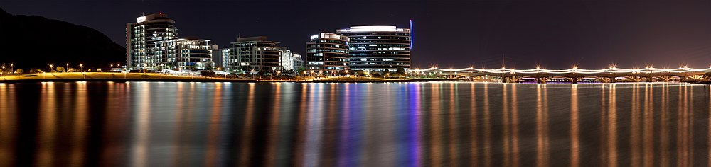 Tempe cityscape from Tempe Town Lake
Climate[edit]
hideClimate data for Tempe, Arizona Month Jan Feb Mar Apr May Jun Jul Aug Sep Oct Nov Dec Year Average high °F (°C) 69
(21)73
(23)78
(26)86
(30)95
(35)103
(39)105
(41)103
(39)100
(38)89
(32)78
(26)68
(20)87
(31)Average low °F (°C) 39
(4)42
(6)46
(8)52
(11)60
(16)68
(20)75
(24)75
(24)68
(20)56
(13)45
(7)38
(3)55
(13)Average precipitation inches (mm) 1.08
(27.4)1.20
(30.5)1.11
(28.2)0.28
(7.1)0.14
(3.6)0.03
(0.8)1.06
(26.9)1.36
(34.5)0.68
(17.3)0.64
(16.3)0.69
(17.5)1.10
(27.9)9.37
(238)Source: The Weather Channel[6] Demographics[edit]
Historical population Census Pop. %± 1880 135 — 1890 897 564.4% 1900 885 −1.3% 1910 1,473 66.4% 1920 1,963 33.3% 1930 2,495 27.1% 1940 2,906 16.5% 1950 7,684 164.4% 1960 24,897 224.0% 1970 63,550 155.3% 1980 106,919 68.2% 1990 141,865 32.7% 2000 158,945 12.0% 2010 161,719 1.7% Est. 2017 185,038 [3] 14.4%  Downtown Tempe from Hayden Butte.
As of the 2010 census, there were 161,719 people, 63,602 households, and 33,645 families residing in the city. The population density was 3,959.4 people per square mile (1,528.8/km²). There were 67,068 housing units at an average density of 1,674.1 per square mile (646.4/km²). The racial makeup of the city was 77.51% White, 3.66% Black or African American, 2.01% Native American, 4.75% Asian, 0.29% Pacific Islander, 8.49% from other races, and 3.30% from two or more races. 17.95% of the population were Hispanic or Latinoof any race.
There were 63,602 households out of which 24.4% had children under the age of 18 living with them, 38.4% were married couples living together, 9.7% had a female householder with no husband present, and 47.1% were non-families. 28.5% of all households were made up of individuals and 4.6% had someone living alone who was 65 years of age or older. The average household size was 2.41 and the average family size was 3.05.
In the city, the population was spread out with 19.8% under the age of 18, 21.3% from 18 to 24, 33.2% from 25 to 44, 18.5% from 45 to 64, and 7.2% who were 65 years of age or older. The median age was 29 years. For every 100 females, there were 106.9 males. For every 100 females age 18 and over, there were 107.1 males.
The median income for a household in the city was $42,361, and the median income for a family was $55,237. Males had a median income of $36,406 versus $28,605 for females. The per capita income for the city was $22,406. About 7.5% of families and 14.3% of the population were below the poverty line, including 13.6% of those under age 18 and 5.1% of those age 65 or over.
Economy[edit]
 hideThis section has multiple issues. Please help improve it or discuss these issues on the talk page. (Learn how and when to remove these template messages)This section needs additional citations for verification. (August 2009)This section needs expansion. You can help by adding to it. (March 2008)
 Hayden Ferry Lakeside development on the north end of Downtown Tempe
Tempe is the headquarters and executive office of one Fortune 500 company: Insight Enterprises. Limelight Networks,[7] LifeLock,[8] First Solar,[9][10] the Salt River Project, Circle K, Fulton Homes and Mobile Mini are also headquartered in Tempe. Cold Stone Creamery was originally headquartered in Tempe and location #0001 is still in operation today at 3330 S McClintock Drive in Tempe. Tempe is also home to the first and largest campus of Arizona State University. It was the longtime host of the Fiesta Bowl, although the BCSgame moved to University of Phoenix Stadium, located in Glendale, in 2007. It then began hosting the Insight Bowl which is now known as the Cactus Bowl. Currently, there is no bowl game in Tempe because of renovations to Sun Devil Stadium. Edward Jones Investments has a regional headquarters in Tempe.[11]
Tempe houses several great performance venues including Gammage Auditorium and the Tempe Center for the Arts.
Tempe Town Lake is home to many national and international events, such as Ironman Arizona and Rock n Roll Marathon. Gammage Auditorium was also the site of one of the three Presidential debates in 2004, and Super Bowl XXX was played at Sun Devil Stadium. Additionally, Tempe is the spring training host city of the Los Angeles Angels of Anaheim.
One of Arizona's largest shopping malls, Arizona Mills, sits near the border with the town of Guadalupe. The city also serves as the first Arizona IKEA branch location, also near the southern boundary. Tempe Marketplace a large open air mall featuring live music and water and laser shows is located just southeast of Tempe Town Lake. Tempe can boast an array of wholesalers and manufacturers. Mill Avenue, located just west of Hayden Butte, is a shopping and entertainment area in the city popular with pedestrians and students. With the completion of Tempe Town Lake, commercial and high-rise development along the reservoir quickly transformed the cityscape of Mill Avenue and the skyline of downtown Tempe. Many gourmet foods are made in Tempe, such as Decio Pasta, Sting and Linger Salsa, Cartel Coffee, Four Peaks Brewery Beer and much more. Tempe is now produces more blue-veined cheese than anywhere else in the country other than Wisconsin, thanks to Arizona Cheese Company. Visit www/tempe.gov/MadeinTempe
Top employers[edit]
State Farm is among the top employers in Tempe, with a regional campus along Tempe Town Lake. According to Tempe's 2016 Comprehensive Annual Financial Report,[12] the top employers in the city are:
# Employer # of Employees 1 Arizona State University 8,818 2 State Farm 8,500 3 Wells Fargo 3,300 4 US Airways 2,537 5 SRP 2,236 6 ABM Industries 2,000 7 JP Morgan Chase 1,958 8 City of Tempe 1,824 9 Honeywell 1,658 10 Tempe Elementary School District#3 1,619 Arts and culture[edit]
![[icon]](https://upload.wikimedia.org/wikipedia/commons/thumb/1/1c/Wiki_letter_w_cropped.svg/20px-Wiki_letter_w_cropped.svg.png) This section needs expansionwith: section. You can help by adding to it. (October 2010)
This section needs expansionwith: section. You can help by adding to it. (October 2010)The Public Art program coordinates artists with building designers to install permanent and temporary public art projects. Since 1988, more than 50 projects have been commissioned by the Tempe's Cultural Services Division. The Art in Private Development ordinance of 1991 has helped add more than 60 privately owned pieces of art to the city, accessible by the public.[13]
Performing arts[edit]
Tempe enjoyed a thriving alternative music scene throughout the 1980s and '90s, producing such acts as the Gin Blossoms, Meat Puppets, Dead Hot Workshop, The Refreshments, Roger Clyne and the Peacemakers, Hans Olson, and The Maine.
Public libraries[edit]
Tempe Public Library serves Tempe. The children's library is now 18,816 square feet large.[14]
Tourism[edit]
Many of the reasons people visit Tempe are places and events, such as P.F. Chang's Rock 'n' Roll Arizona Marathon & 1/2 Marathon, Tempe Marketplace, Arizona Mills, Mill Avenue, and Tempe Town Lake.[15] Downtown Tempe offers more than 175 restaurants, nightclubs and retail shops to cater to city guests.[16]
Mill Ave is a famous Arizona bar district here containing several bars and restaurants that cater to the growing university crowd. Along with bars and restaurants are business complexes and university buildings. Several longtime bar establishments include Mill Ave Cue Club and Rula Bula Irish Pub.
The Tempe Tourism Office, located on Mill Avenue's downtown district, provides maps and additional information about hotels and upcoming city events.[17]
Historic properties[edit]
There are numerous properties in the city of Tempe which are considered to be historical and have been included either in the National Register of Historic Places.[18]
Sports[edit]
 Sun Devil Stadium
 Tempe Diablo Stadium
There are currently no major league professional sports teams playing in Tempe. However, from 1988 to 2006, Sun Devil Stadium hosted the Arizona Cardinals of the National Football League. They have since moved to the University of Phoenix Stadium in Glendale for games, but maintain their headquarters and training facility in Tempe. Many residents follow the teams in nearby Phoenix and Glendale. (For more information, read the sports section on the Phoenix page)[19]
The Arizona State University Sun Devils compete in football, basketball, baseball, as well as a number of other sports in the Pac-12 Conference of the NCAA. The Sun Devils football team plays their games at Sun Devil Stadium. Their nearest rival is the University of Arizona Wildcats, in Tucson. The two teams compete in the "Duel in the Desert" for control of the Territorial Cup. The Sun Devil Stadium had hosted the annual Fiesta Bowl, until the 2007 game moved to the new University of Phoenix Stadium in Glendale.
The Los Angeles Angels of Anaheim have their spring training at Tempe Diablo Stadium. Tempe Diablo Stadium was built in 1968 and holds 9,785 people. The Angels moved here in 1993 from Palm Springs, California.
Rugby union is a developing sport in Tempe as well as in the Phoenix metropolitan area. The multiple clubs, ranging from men's and women's clubs to collegiate and Under 19, are part of the Arizona Rugby Union.[20] Notable clubs are Arizona State University Rugby Football Club and the Tempe "Old Devils" Rugby Club.[21]
Parks and recreation[edit]
This section needs expansionwith: section. You can help by adding to it. (October 2010)Tempe is home to many outdoor activities. Tempe Town Lake is a publicly accessible lake that is run by City of Tempe. The lake provides recreation activities to residents and tourists, but also helps protect the surrounding area from flooding. The City of Tempe estimated that 2.7 million people visited the lake in 2013.[22] Papago and South Mountain Parks offer hiking, mountain and road biking, rock climbing, frisbee golf, and equestrian activities. Tempe is also home to the annual Ironman Triathlon, which takes place in late November.
Government[edit]
- Mayor: Mark Mitchell
- Vice Mayor: Robin Arredondo-Savage
- City Manager: Andrew Ching
- Chief of Police: Sylvia Moir
- Fire Chief: Greg Ruiz
- City Attorney: Judith R. Baumann (Interim City Attorney)
- City Council Members: Kolby Granville, Joel Navarro, Lauren Kuby, David Schapira, and Randy Keating.
The city has had 31 mayors since 1894.
- 1894–1896: Fenn J. Hart
- 1896–1897: E.A. Murphy
- 1897–1902: John Knight
- 1902–1903: Samuel Brown
- 1903–1912: J.A. Dins
- 1912–1914: Joseph T. Birchett
- 1914–1916: George M. Frizzell
- 1916–1920: J.A. Dins
- 1920–1922: C.M. Woodward
Phoenix
Info from https://en.wikipedia.org/wiki/Phoenix,_Arizona
Phoenix (/?fi?n?ks/) is the capital and most populous city of the U.S. state of Arizona. With 1,626,078 people (as of 2017), Phoenix is the fifth most populous city nationwide, the most populous state capital in the United States, and the only state capital with a population of more than one million residents.[5][6]
Phoenix is the anchor of the Phoenix metropolitan area, also known as the Valley of the Sun, which in turn is a part of the Salt River Valley. The metropolitan area is the 12th largest by population in the United States, with approximately 4.73 million people as of 2017.[7] In addition, Phoenix is the seat of Maricopa County, and at 517.9 square miles (1,341 km2), it is the largest city in the state, more than twice the size of Tucson and one of the largest cities in the United States.[8]
Settled in 1867 as an agricultural community near the confluence of the Salt and Gila Rivers, Phoenix incorporated as a city in 1881. It became the capital of Arizona Territory in 1889.[9] Located in the northeastern reaches of the Sonoran Desert, Phoenix has a hot desert climate.[10][11] Despite this, its canal system led to a thriving farming community with many of the original crops, such as alfalfa, cotton, citrus, and hay, remaining important parts of the Phoenix economy for decades.[12][13] Cotton, cattle, citrus, climate, and copper were known locally as the "Five C's" of Phoenix's economy. These industries remained the driving forces of the city until after World War II, when high-tech companies began to move into the valley and air conditioning made Phoenix's hot summers more bearable.[14]
The city averaged a four percent annual population growth rate over a 40-year period from the mid-1960s to the mid-2000s.[15] This growth rate slowed during the Great Recession of 2007–09, and has rebounded slowly.[16] Phoenix is the cultural center of the Valley of the Sun, as well as the entire state.[17]
Phoenix, ArizonaCity of Phoenix  Images, from top, left to right: Papago Park, Saint Mary's Basilica, Chase Tower, Downtown, Arizona Science Center, Rosson House, the light rail, a saguaro cactus, and the McDowell Mountains
Flag
SealNickname(s): "Valley of the Sun", "The Valley" Location within Maricopa County
 PhoenixLocation within Arizona
Coordinates: 33°27′N 112°04′WCoordinates: 33°27′N 112°04′W Country United States State Arizona County Maricopa Settled 1867 Incorporated February 25, 1881 Government • Type Council-Manager • Body Phoenix City Council • Mayor Thelda Williams Area • State Capital 518.90 sq mi (1,343.94 km2) • Land 517.64 sq mi (1,340.69 km2) • Water 1.25 sq mi (3.25 km2) • Metro 14,565.76 sq mi (37,725.1 km2) Elevation 1,086 ft (331 m) Population • State Capital 1,445,632 • Estimate (2017)[4]1,626,078 • Rank US: 5th • Density 3,119.94/sq mi (1,204.61/km2) • Urban 3,629,114 (US: 12th) • Metro 4,737,270 (US: 12th) • Demonym Phoenician Time zone UTC−7 (MST (no DST)) ZIP codes 85001–85099Area codes FIPS code 04-55000 GNIS ID(s) 44784, 2411414 Major airport Phoenix Sky Harbor International Airport Interstates 

Rapid Transit Valley Metro Rail Website www.phoenix.gov MAYBE LATERCLOSEPhoenix (/?fi?n?ks/) is the capital and most populous city of the U.S. state of Arizona. With 1,626,078 people (as of 2017), Phoenix is the fifth most populous city nationwide, the most populous state capital in the United States, and the only state capital with a population of more than one million residents.[5][6]
Phoenix is the anchor of the Phoenix metropolitan area, also known as the Valley of the Sun, which in turn is a part of the Salt River Valley. The metropolitan area is the 12th largest by population in the United States, with approximately 4.73 million people as of 2017.[7] In addition, Phoenix is the seat of Maricopa County, and at 517.9 square miles (1,341 km2), it is the largest city in the state, more than twice the size of Tucson and one of the largest cities in the United States.[8]
Settled in 1867 as an agricultural community near the confluence of the Salt and Gila Rivers, Phoenix incorporated as a city in 1881. It became the capital of Arizona Territory in 1889.[9] Located in the northeastern reaches of the Sonoran Desert, Phoenix has a hot desert climate.[10][11] Despite this, its canal system led to a thriving farming community with many of the original crops, such as alfalfa, cotton, citrus, and hay, remaining important parts of the Phoenix economy for decades.[12][13] Cotton, cattle, citrus, climate, and copper were known locally as the "Five C's" of Phoenix's economy. These industries remained the driving forces of the city until after World War II, when high-tech companies began to move into the valley and air conditioning made Phoenix's hot summers more bearable.[14]
The city averaged a four percent annual population growth rate over a 40-year period from the mid-1960s to the mid-2000s.[15] This growth rate slowed during the Great Recession of 2007–09, and has rebounded slowly.[16] Phoenix is the cultural center of the Valley of the Sun, as well as the entire state.[17]
Contents
History[edit]
Early history[edit]
 Map of Hohokam lands ca. 1350
For more than 2,000 years, the Hohokam people occupied the land that would become Phoenix.[18][19] The Hohokam created roughly 135 miles (217 kilometers) of irrigation canals, making the desert land arable. Paths of these canals would later become used for the modern Arizona Canal, Central Arizona Project Canal, and the Hayden-Rhodes Aqueduct. The Hohokam also carried out extensive trade with the nearby Anasazi, Mogollon and Sinagua, as well as with the more distant Mesoamerican civilizations.[20] It is believed that between AD 1300 and AD 1450, periods of drought and severe floods led to the Hohokam civilization's abandonment of the area.[21]
After the departure of the Hohokam, groups of Akimel O'odham (commonly known as Pima), Tohono O'odham and Maricopa tribes began to use the area, as well as segments of the Yavapai and Apache.[22] The O'odham were offshoots of the Sobaipuri tribe, who in turn were thought to be the descendants of the formerly urbanized Hohokam.[23][24][25]
The Akimel O'odham were the major Native American group in the area, and lived in small villages, with well-defined irrigation systems, which spread over the entire Gila River Valley, from Florence in the east to the Estrellas in the west. Their crops included corn, beans, and squash for food, while cotton and tobacco were also cultivated. Mostly a peaceful group, they did band together with the Maricopa for their mutual protection against incursions by both the Yuma and Apache tribes.[26] The Maricopa are part of the larger Yuma people; however, they migrated east from the lower Colorado and Gila Rivers in the early 1800s, when they began to be enemies with their Yuma brethren, settling amongst the existing communities of the Akimel O'odham.[27][28][22]
The Tohono O'odham lived in the region as well, but their main concentration was to the south, and stretched all the way to the Mexican border.[29] Living in small settlements, the O'odham were seasonal farmers who took advantage of the rains, rather than the large-scale irrigation of the Akimel. They grew crops such as sweet corn, tapery beans, squash, lentils, sugar cane, and melons, as well as taking advantage of native plants, such as saguaro fruits, cholla buds, mesquite tree beans, and mesquite candy (sap from the mesquite tree). They also hunted local game such as deer, rabbit, and javelina for meat.[30][31]
When the Mexican–American War ended in 1848, Mexico ceded its northern zone to the United States and residents of that region became U.S. citizens. The Phoenix area became part of the New Mexico Territory.[32] In 1863 the mining town of Wickenburg was the first to be established in what is now Maricopa County, to the northwest of modern Phoenix. At the time Maricopa County had not yet been incorporated: the land was within Yavapai County, which included the major town of Prescott to the north of Wickenburg.
The U.S. Army created Fort McDowell on the Verde River in 1865 to forestall Native American uprisings.[33] The fort established a camp on the south side of the Salt River by 1866, which was the first non-native settlement in the valley after the decline of the Hohokam. In later years, other nearby settlements would form and merge to become the city of Tempe,[34] but this community was incorporated after Phoenix.
Founding and incorporation[edit]
 The Phillip Darrell Duppa adobe house was built in 1870 and is the oldest known house in Phoenix. The homestead is named after "Lord" Darrell Duppa, an Englishman who is credited with naming Phoenix and Tempe as well as founding the town of New River.
The history of the city of Phoenix begins with Jack Swilling, a Confederate veteran of the Civil War. In 1867, while traveling through the Salt River Valley, he saw a potential for farming, much like the military had already cultivated further east, near Fort McDowell. He formed a small community that same year about four miles (six km) east of the present city. Lord Darrell Duppa, one of the original settlers in Swilling's party, suggested the name "Phoenix", as it described a city born from the ruins of a former civilization.[18]
The Board of Supervisors in Yavapai County, which at the time encompassed Phoenix, officially recognized the new town on May 4, 1868, and the first post office was established the following month, with Swilling as the postmaster.[18] On February 12, 1871, the territorial legislature created Maricopa County, the sixth one formed in the Arizona Territory, by dividing Yavapai County. The first election for county office was held in 1871, when Tom Barnum was elected the first sheriff, running unopposed when the other two candidates, John A. Chenowth and Jim Favorite, fought a duel wherein Chenowth killed Favorite, and then was forced to withdraw from the race.[18]
The town grew during the 1870s, and President Ulysses S. Grant issued a land patent for the present site of Phoenix on April 10, 1874. By 1875, the town had a telegraph office, sixteen saloons, and four dance halls, but the "townsite-commissioner form of government" needed an overhaul, so that year an election was held in which three village trustees, as well as several other officials, were elected.[18] By 1880, the town's population stood at 2,453.[35]
 Aerial lithograph of Phoenix from 1885
By 1881, Phoenix's continued growth made the existing village structure with a board of trustees obsolete. The Territorial Legislature passed "The Phoenix Charter Bill", incorporating Phoenix and providing for a mayor-council government, which became official on February 25, 1881 when it was signed by Governor John C. Fremont, officially incorporating Phoenix as a city with an approximate population of 2,500.[18]
In the 1880s, the arrival of the railroad in the Valley was the first of several key events that altered the economy of Phoenix. Phoenix became a trade center, with its products reaching eastern and western markets. In response, the Phoenix Chamber of Commerce was organized on November 4, 1888.[36] Earlier in 1888 the city offices were moved into the new City Hall, at Washington and Central.[18] When the territorial capital was moved from Prescott to Phoenix in 1889, the temporary territorial offices were also located in City Hall.[37] With the arrival of the Santa Fe, Prescott and Phoenix Railroad in 1895, Phoenix was connected to Prescott, Flagstaff and other communities in the northern part of the territory. The increased access to commerce expedited the city's economic rise. The year 1895 also saw the establishment of Phoenix Union High School, with an enrollment of 90.[18]
1900 to World War II[edit]
 Central Avenue, Phoenix, 1908
On February 25, 1901, Governor Oakes Murphy dedicated the permanent Capitol building,[18] and the Carnegie Free Library opened seven years later, on February 18, 1908, dedicated by Benjamin Fowler.[38] The National Reclamation Act was signed by President Theodore Roosevelt in 1902, which allowed for dams to be built on waterways in the west for reclamation purposes.[39] The first dam constructed under the act, Salt River Dam#1, began in 1903. It supplied both water and electricity, becoming the first multi-purpose dam, and Roosevelt himself attended the official dedication on May 18, 1911. At the time, it was the largest masonry dam in the world, forming a lake in the mountain east of Phoenix.[40] The dam would be renamed after Teddy Roosevelt in 1917,[41] and the lake would follow suit in 1959.[42]
 The former city flag of Phoenix, adopted in November 1921
On February 14, 1912, Phoenix became a state capital, as Arizona was admitted to the Union as the 48th state under President William Howard Taft.[43] This occurred just six months after Taft had vetoed a joint congressional resolution granting statehood to Arizona, due to his disapproval of the state constitution's position regarding the recall of judges.[44] In 1913, Phoenix adopted a new form of government, changing from a mayor-council system to council-manager, making it one of the first cities in the United States with this form of city government. After statehood, Phoenix's growth started to accelerate, and eight years later, its population had reached 29,053. In 1920, Phoenix would see its first skyscraper, the Heard Building.[18] In 1929, Sky Harbor was officially opened, at the time owned by Scenic Airways. It would later be purchased in 1935 by the city, which operates it to this day.[45]
 Phoenix skyline – ca. 1940
On March 4, 1930, former U.S. President Calvin Coolidge dedicated a dam on the Gila River named in his honor. However, the state had just been through a long drought, and the reservoir which was supposed to be behind the dam was virtually dry. The humorist Will Rogers, who was also on hand as a guest speaker joked, "If that was my lake, I'd mow it."[46] Phoenix's population had more than doubled during the 1920s, and now stood at 48,118.[18] It was also during the 1930s that Phoenix and its surrounding area began to be called "The Valley of the Sun", which was an advertising slogan invented to boost tourism.[47]
During World War II, Phoenix's economy shifted to that of a distribution center, transforming into an "embryonic industrial city" with the mass production of military supplies.[18]There were three air force fields in the area: Luke Field, Williams Field, and Falcon Field, as well as two large pilot training camps, Thunderbird Field No. 1 in Glendale and Thunderbird Field No. 2 in Scottsdale.[18][48][49]
Post-World War II explosive growth[edit]
A town that had just over 65,000 residents in 1940 became America's sixth largest city by 2010, with a population of nearly 1.5 million, and millions more in nearby suburbs. When the war ended, many of the men who had undergone their training in Arizona returned bringing their new families. Learning of this large untapped labor pool enticed many large industries to move their operations to the area.[18] In 1948 high-tech industry, which would become a staple of the state's economy, arrived in Phoenix when Motorola chose Phoenix for the site of its new research and development center for military electronics. Seeing the same advantages as
Scottsdale
Scottsdale, Arizona
Jump to navigationJump to search This article needs additional citations for verification. (March 2017) (Learn how and when to remove this template message)Scottsdale, Arizona
City of Scottsdale 


 Clockwise from top: Downtown Scottsdale waterfront, The Phoenician Golf Club, Scottsdale Spire, McDowell Mountains, Taliesin West
Seal
LogoNickname(s): "The West's Most Western Town" (official) Location of Scottsdale in Maricopa County, Arizona
Scottsdale, ArizonaLocation in the United States
Location of Scottsdale in Maricopa County, Arizona
Scottsdale, ArizonaLocation in the United StatesCoordinates: 33°30′N 111°56′WCoordinates: 33°30′N 111°56′W Country United States State Arizona County Maricopa Incorporated 1951 Named for Winfield Scott Government • Type Council-Manager • Mayor Jim Lane (R) Area • Total 184.41 sq mi (477.63 km2) • Land 183.94 sq mi (476.41 km2) • Water 0.47 sq mi (1.22 km2) Elevation 1,257 ft (380 m) Population • Total 217,385 • Estimate (2016)[3]246,645 • Rank US: 92nd • Density 1,340.88/sq mi (517.72/km2) Time zone UTC−7 (MST (no DST)) ZIP codes 85250–85271Area code(s) 480 FIPS code 04-65000 GNIS ID 11029[4] Website www.scottsdaleaz.gov Scottsdale (O'odham: Va?ai S-va?on?; Yaqui: Eskatel) is a city in the eastern part of Maricopa County, Arizona, United States, part of the Greater Phoenix Area. Named Scottsdale in 1894 after founder Winfield Scott and incorporated in 1951 with a population of 2,000, the 2015 population of the city is estimated to be 236,839 according to the U.S. Census Bureau.[5] The New York Times described downtown Scottsdale as "a desert version of Miami's South Beach" and as having "plenty of late night partying and a buzzing hotel scene."[6] Its slogan is "The West's Most Western Town."[7]
Scottsdale, 31 miles long and 11.4 miles wide at its widest point, shares boundaries with many other municipalities and entities. On the west, Scottsdale is bordered by Phoenix, Paradise Valley and unincorporated Maricopa County land. Carefree is located along the western boundary, as well as sharing Scottsdale's northern boundary with the Tonto National Forest. To the south Scottsdale is bordered by Tempe. The southern boundary is also occupied by the Salt River Pima-Maricopa Indian Community, which extends along the eastern boundary, which also borders Fountain Hills, the McDowell Mountain Regional Park and more unincorporated Maricopa County land.[8]
2680 South Val Vista Drive, Suite 101
Gilbert, AZ 85295
Neighborhoods
Gilbert
Info from https://en.wikipedia.org/wiki/Gilbert,_Arizona
Gilbert is a town in Maricopa County, Arizona, United States, located southeast of Phoenix, within the Phoenix metropolitan area. Once known as the "Hay Shipping Capital of the World",[4] Gilbert is currently the most populous incorporated town in the United States. It is the sixth-largest municipality in Arizona, and the fifth-largest in the Metropolitan Phoenix Area.
Gilbert encompasses 76 square miles (197 km2) and has made a rapid transformation from an agriculture-based community to an economically diverse suburban center located in the southeast valley of the Greater Phoenix area. In the last three decades, Gilbert has grown at an extremely high rate, increasing in population from 5,717 in 1980 to 208,453 as of the 2010 census. The town grew at an average annual growth rate of nearly 13% during this 30-year period.
History[edit]
Gilbert owes its beginnings to William "Bobby" Gilbert who provided land to the Arizona Eastern Railway in 1902 to construct a rail line between Phoenix and Florence, Arizona. Ayer's Grocery Store, the first store in Gilbert, opened in 1910 and became the location of the first post office in 1912. The location of the town post office moved several times before settling on the east side of Gilbert Road in downtown, where it still stands today. In 1912, many Mormons who had fled the Mormon colonies in Mexico due to the actions of the forces of Pancho Villa settled in Gilbert. By 1915, they began holding church meetings at the Gilbert Elementary School. In 1918, they were organized into the Gilbert Ward.[5]
Incorporated in July 1920, Gilbert was primarily a farming community fueled by the rail line and construction of the Roosevelt Dam and the Eastern and Consolidated Canals. It remained an agricultural town for many years and was known as the "Hay Capital of the World"[6] from 1911 until the late 1920s.
Geography[edit]
According to the United States Census Bureau, in the 2000 Census, the town had an estimated area of 40 square miles (104 km2). As of 2009, and due to annexations the current Municipal Planning Area of Gilbert has a total area of 76.0 square miles (197 km2), of which, 75.76 square miles (196.2 km2) is land and 0.24 square miles (0.6 km2) is water.
Climate[edit]
Gilbert has a hot desert climate (Köppen climate classification BWh).
| hideClimate data for Gilbert, Arizona | |||||||||||||
|---|---|---|---|---|---|---|---|---|---|---|---|---|---|
| Month | Jan | Feb | Mar | Apr | May | Jun | Jul | Aug | Sep | Oct | Nov | Dec | Year |
| Record high °F (°C) | 89 (32) |
95 (35) |
99 (37) |
106 (41) |
118 (48) |
116 (47) |
119 (48) |
115 (46) |
113 (45) |
107 (42) |
97 (36) |
86 (30) |
119 (48) |
| Average high °F (°C) | 67 (19) |
71 (22) |
77 (25) |
85 (29) |
94 (34) |
104 (40) |
106 (41) |
104 (40) |
99 (37) |
89 (32) |
75 (24) |
67 (19) |
87 (30) |
| Average low °F (°C) | 41 (5) |
45 (7) |
49 (9) |
54 (12) |
61 (16) |
70 (21) |
77 (25) |
76 (24) |
70 (21) |
59 (15) |
47 (8) |
40 (4) |
57 (14) |
| Record low °F (°C) | 15 (−9) |
19 (−7) |
24 (−4) |
30 (−1) |
37 (3) |
43 (6) |
54 (12) |
51 (11) |
40 (4) |
30 (−1) |
22 (−6) |
17 (−8) |
15 (−9) |
| Average precipitation inches (mm) | 1.01 (25.7) |
1.03 (26.2) |
1.19 (30.2) |
0.33 (8.4) |
0.13 (3.3) |
0.04 (1) |
0.89 (22.6) |
1.14 (29) |
0.89 (22.6) |
0.81 (20.6) |
0.77 (19.6) |
0.98 (24.9) |
9.21 (234.1) |
| Source: The Weather Channel [7] | |||||||||||||
Demographics[edit]
|
This section is in a list format that may be better presented using prose. (December 2015)
|
| Historical population | |||
|---|---|---|---|
| Census | Pop. | %± | |
| 1920 | 865 | — | |
| 1930 | 791 | −8.6% | |
| 1940 | 837 | 5.8% | |
| 1950 | 1,114 | 33.1% | |
| 1960 | 1,833 | 64.5% | |
| 1970 | 1,971 | 7.5% | |
| 1980 | 5,717 | 190.1% | |
| 1990 | 29,188 | 410.5% | |
| 2000 | 109,697 | 275.8% | |
| 2010 | 208,453 | 90.0% | |
| Est. 2017 | 242,354 | [3] | 16.3% |
| U.S. Decennial Census[8] | |||


As of the census of 2010, there were 208,453 people, 74,147 housing units, and 3.01 persons per household.
- Fastest growing municipality in the United States from 1990–2003 (U.S. Census Bureau)
- Currently the 4th fastest growing municipality in the United States (U.S. Census Bureau – 2009)
- Ranked by CNN's Money magazine in 2008 as one of the best places to live in the United States[9]
- One of the top 25 safest cities in the United States[10]
- 34.5% of Gilbert residents hold a bachelor's degree or higher.[11]
- Highest household median income in the Phoenix Metropolitan Area with population 50,000+ (U.S. Census Bureau 2005)
According to Nielsen's Claritas demographics,[11] in 2009 the racial makeup of the town was:
- 81.51% White
- 15.39% Hispanics or Latinos
- 3.08% Black or African American
- 0.79% Native American
- 4.70% Asian
- 0.23% Pacific Islander
- 5.97% from other races
- 3.73% from two or more races
2009 estimated population data by gender/age:[11]
- 31.37 average age male/female
- 50.22% male
- 30.03 est. average age
- 49.78% female
- 31.82 est. average age
- 37.14% population under 21
- 33.25% population under 18
- 70.01% population over 16
- 66.76% population over 18
- 62.86% population over 21
- 5.30% population over 65
2009 estimated population age 15+ by marital status:[11]
- 20.87% never married
- 66.71% married, spouse present
- 2.23% married, spouse absent
- 2.11% widowed
- 8.07% divorced
2009 estimated population age 25+ educational attainment:[11]
- 92.33% high school/GED or higher
- 37.5% bachelor's degree or higher
- 10.46% master's degree or higher
2009 estimated household by household income:[11]
- $109,213 average household income
- $89,077 median household income
- $35,559 per capita Income
- 2.28% of families are below the poverty level
Religion[edit]
Various religious denominations are represented in Gilbert. The town has been known for its high Mormon population, a fact evidenced by the LDS church's building of a temple in Gilbert, dedicated March 2, 2014.[12][13]
Economy[edit]
Largest employers[edit]
According to the town's 2013 Comprehensive Annual Financial Report,[14] the top employers in the city are:
| # | Employer | # of employees |
|---|---|---|
| 1 | Gilbert Public Schools | 3,642 |
| 2 | Banner Health | 2,268 |
| 3 | Mercy Gilbert Medical Center | 1,233 |
| 4 | Town of Gilbert | 1,191 |
| 5 | Fry's Food and Drug | 966 |
| 6 | Go Daddy | 950 |
| 7 | Walmart | 791 |
| 8 | Chandler Unified School District | 518 |
| 9 | B H Drywall | 500 |
| 10 | Dillard's Retail and Distribution | 490 |
Arts and culture[edit]
Historic properties[edit]
Various properties in the town of Gilbert are considered historical and have been included either in the National Register of Historic Places[15] or listed as such in the Gilbert Historic District. In the gallery at the end of the article are images of some of these properties.
Music and dance[edit]
These performers have been associated with Gilbert:
- Elektrolytes, dance crew that won season 7 of America's Best Dance Crew[citation needed]
- Lydia, band[citation needed][16]
- Scary Kids Scaring Kids, band[citation needed]
- Lindsey Stirling, violinist, dancer, and performer; Mesquite High School graduate[17]
Government[edit]
Gilbert was recognized in 2010 as the "36th Best Place to Live in the nation",[18] as well as among the nation's "top places to live and learn",[18] by GreatSchools.org. Washington, DC-based CQ Press rated Gilbert the "safest municipality in Arizona, and 25th safest in the nation." [19]
Since Gilbert remains incorporated as a town, it lacks the additional powers possessed by nearby Mesa and Chandler, which are incorporated as cities. For instance, Arizona towns do not have as much power to regulate utilities and construction within their borders as cities possess.[20] Unlike most of its neighboring communities, Gilbert is theoretically vulnerable to annexation.[21]
The town is part of Arizona's 5th congressional district, which is represented by Republican and Gilbert resident Andy Biggs.[22] The mayor of Gilbert is Jenn Daniels.
Crime[edit]
| Gilbert | |
|---|---|
| Crime rates* (2014) | |
| Violent crimes | |
| Homicide | 0 |
| Robbery | 17 |
| Aggravated assault | 60 |
| Total violent crime | 89 |
| Property crimes | |
| Burglary | 246 |
| Larceny-theft | 1,175 |
| Motor vehicle theft | 54 |
| Arson | 10 |
| Total property crime | 1,475 |
|
Notes
*Number of reported crimes per 100,000 population.
2014 population: 235,430
Source: 2014 FBI UCR Data |
|
Gilbert is rated as a town of relatively low crime. According to FBI records, Gilbert was the largest town in the United States with zero murders in 2005, 2007, and 2014.[citation needed]
Education[edit]
Most of Gilbert is zoned to schools in the Gilbert Public Schools, while other portions are zoned to districts including the Chandler Unified School District, Mesa Public Schools, and the Higley Unified School District. Also in Gilbert are charter schools such as Edu-Prize (the first charter school in Arizona). The town is also home to Gilbert Christian Schools, a chain of private schools.
Infrastructure[edit]
Transportation[edit]
Gilbert is primarily served by one area freeway—the Santan Freeway portion of Loop 202. A small section of the US 60 Superstition Freeway also skirts the northern boundary of the town at the Higley Road interchange (Exit 186). Several regional arterials also serve the area, including Williams Field Road, Chandler Boulevard, and Gilbert Road. The town enjoys relative closeness to Phoenix Mesa Gateway Airport, which is located in east Mesa, and is a twenty-five-minute drive from Phoenix Sky Harbor International Airport.
Recently, a park-and-ride facility was constructed in downtown Gilbert for bus service and future commuter rail service. Although the facility borders the Union Pacific(formerly Southern Pacific) tracks and has provisions for commuter rail service, there is currently no such service. Bus service is limited in Gilbert, with some north-south routes in Mesa dead-ending at Baseline Road before entering Gilbert. Routes that serve portions of Gilbert include the 108-Elliot Road, 112-Country Club/Arizona Avenue, 136-Gilbert Road, 140-Ray Road, 156-Chandler Boulevard/Williams Field Road, 184-Power Road, and 531-Mesa/Gilbert Express, with most of these routes operating at 30 minute frequency on weekdays. Sunday service is only available on Routes 108, 112, 156, and 184. Most people get around by cars or bikes. The city of Gilbert has a low percentage of households without a car. In 2015, 1.9 percent of Gilbert households lacked a car, and the figure was virtually unchanged in 2016 (1.7 percent). The national average was 8.7 percent in 2016. Gilbert averaged 2.08 cars per household in 2016, compared to a national average of 1.8.[23]
Notable people[edit]
|
This section contains embedded lists that may be poorly defined, unverified or indiscriminate. (December 2010)
|
- Jim Bechtel, professional poker player; World Champion of Poker in 1993; lives in Gilbert[24]
- Dave Burba, currently lives in Gilbert; pitcher for late 1990s Cleveland Indians[25]
- Marquis Cooper, professional linebacker; played for Highland High School[26]
- Ken Delo, singer best known for The Lawrence Welk Show; lives in Gilbert[citation needed]
- The Honky Tonk Man, pro wrestler (real name Roy Wayne Farris); lives in Gilbert[citation needed]
- Ryan Fitzpatrick, NFL quarterback; played for Highland High School[27][28]
- Jineane Ford, Miss Arizona USA 1980, Miss USA 1980[29]
- Alan Gordon, professional soccer player; born in Gilbert in 1981[citation needed]
- Dan Hausel, Hall of Fame martial artist; resident of Gilbert since 2006
- Shea Hillenbrand, All-Star professional baseball player[citation needed]
- Darrin Jackson, professional baseball player, 1985-1999; TV broadcaster; currently lives in Gilbert[citation needed]
- Kimberly Joiner, Miss Arizona USA 2008; raised in and still lives in Gilbert[30]
- Naomi Lang, five-time US ice dance champion, 2002 Olympian[citation needed]
- Spencer Larsen, former professional football player; raised in Gilbert; played for Highland High School
- Justin Lassen, artist; currently lives in Gilbert; graduated from Gilbert High School in 2000[dubious ]
- Ryan Leslie, television personality on MTV's The Real World: New Orleans[citation needed]
- Bengie Molina, former Major League Baseball catcher; has lived in Gilbert since 2011[31]
- Alex Naddour, bronze medalist at 2011 World Artistic Gymnastics Championships and in pommel horse at 2016 Summer Olympics; graduate from Highland High School
- Carlos I. Noriega, NASA astronaut; retired United States Marine Corps lieutenant colonel; lives in Gilbert[32]
- Phil Ortega, MLB pitcher, 1960-1969; born in Gilbert in 1939[33]
- Mykayla Skinner, gold medalist at 2014 World Artistic Gymnastics Championships; bronze medalist on vault
- Lindsey Stirling, violinist; dancer; performer; grew up in Gilbert
- Eric Swann, NFL player for Arizona Cardinals; currently lives in Gilbert[citation needed]
- Rick Woolstenhulme, drummer for band Lifehouse[citation needed]
Sister cities[edit]
Gilbert has two sister cities, as designated by Sister Cities International:
 Newtownabbey, County Antrim, Northern Ireland, United Kingdom
 Leshan, Sichuan, China
Gallery[edit]
-
Gilbert Elementary School was built in 1913. It is located at 10 S. Gilbert Rd. and now houses the Gilbert Historical Museum. It is listed in the National Register of Historic Places.
-

Gilbert High Schoolwas built in 1920. It now houses the Gilbert Public School District Office. The structure is listed as historical by the Gilbert Heritage District.
-

The Gilbert Water Tower was built in 1925. The structure is listed as historical by the Gilbert Heritage District.
-

Gilbert's first jail housewas built in 1918 and later used as a pump house. The structure is listed as historical by the Gilbert Heritage District.
-

The Tone Building was built in 1929 and now houses Joe's Real BBQ Restaurant. The structure is listed as historical by the Gilbert Heritage District.
-

Liberty Market was built in 1936. Liberty Market was established by the Dong family. The neon sign which is still on display was designed by Mae Ong, the wife of Ben Ong, who purchased the market in 1943. The structure is listed as historical by the Gilbert Heritage District.
-

The Creed building was built in 1918. It now houses the Farmhouse Restaurant. The structure is listed as historical by the Gilbert Heritage District.
-

The Attaway Phelps-Blakely Building was built in 1910. It now houses the Norwood Furniture store. The structure is listed as historical by the Gilbert Heritage District.
-
The Bank of Gilbertwas built in 1917. It now houses an insurance company. The structure is listed as historical by the Gilbert Heritage District.
-
Clare's Metal Shop was built in 1918. It now houses Bergies Coffee. The structure is listed as historical by the Gilbert Heritage District.
-
Clement's Garage was built in 1934. The structure is listed as historical by the Gilbert Heritage District.
-
The American Legion Post 39 was built in 1934.
See also[edit]
References[edit]
- ^ "2016 U.S. Gazetteer Files". United States Census Bureau. Retrieved July 18, 2017.
- ^ "American FactFinder". United States Census Bureau. Retrieved June 18, 2012.
- ^ Jump up to:a b "Gilbert town, Arizona". Retrieved 2018-09-23.
- ^ Gilbert Profile
- ^ "Gilbert Arizona Community's roots date to 1920". Church News. November 19, 2010. Retrieved September 4, 2012.
- ^ "Gilbert History". Ci.gilbert.az.us. Archived from the original on April 17, 2010. Retrieved September 4, 2012.
- ^ "Average Weather for Gilbert, AZ – Temperature and Precipitation". Weather.com. Retrieved August 24, 2017.
- ^ "Census of Population and Housing"Chandler
Chandler is a city southeast of Phoenix, in Arizona. Its many parks include Desert Breeze Park, with vintage train rides on the Desert Breeze Railroad. Veterans Oasis Park has wetlands and a Sonoran Desert landscape, plus the Solar System Walk, a scale model of the planets. Tumbleweed Park features Playtopia, a playground with themed zones. The Arizona Railway Museum exhibits antique trains.
Find more info Here: http://www.city-data.com/city/Chandler-Arizona.html
Mesa
Info from https://en.wikipedia.org/wiki/Mesa,_Arizona
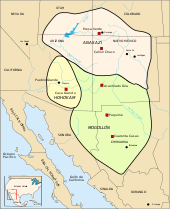
Mesa (/?me?s?/ MAY-s?) is a city in Maricopa County, in the U.S. state of Arizona. It is a suburb located about 20 miles (32 km) east of Phoenix. Mesa is the central city of the East Valley section of the Phoenix Metropolitan Area. It is bordered by Tempe on the west, the Salt River Pima-Maricopa Indian Community on the north, Chandler and Gilbert on the south along with Queen Creek, and Apache Junction on the east.
Mesa is the third-largest city in Arizona, after Phoenix and Tucson, and the 36th-largest city in the US. The city is home to 439,041 people as of 2010 according to the Census Bureau. Mesa is home to numerous higher education facilities including the Polytechnic campus of Arizona State University.
Mesa, ArizonaCity of Mesa 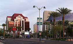 Mesa Bank and Mesa Arts Center building in downtown Mesa
Flag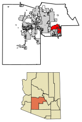 Location of Mesa in Maricopa County, Arizona
MesaLocation in the United States
Location of Mesa in Maricopa County, Arizona
MesaLocation in the United StatesCoordinates: 33°24′54″N 111°49′53″WCoordinates: 33°24′54″N 111°49′53″W Country United States State Arizona County Maricopa Founded 1878 Government • Mayor John Giles (R) Area • City 138.63 sq mi (359.05 km2) • Land 137.88 sq mi (357.10 km2) • Water 0.75 sq mi (1.95 km2) Elevation 1,243 ft (378 m) Population • City 439,041 • Estimate (2017)[3]496,401 • Rank US: 36th • Density 3,514.66/sq mi (1,357.01/km2) • Urban 3,629,114 (US: 12th) • Metro 4,574,531 (US: 12th) Time zone UTC−7 (MST (no DST)) ZIP codes 85200-85299Area code(s) 480 602 FIPS code 04-46000 Website www.mesaaz.gov MAYBE LATERCLOSEMesa (/?me?s?/ MAY-s?) is a city in Maricopa County, in the U.S. state of Arizona. It is a suburb located about 20 miles (32 km) east of Phoenix. Mesa is the central city of the East Valley section of the Phoenix Metropolitan Area. It is bordered by Tempe on the west, the Salt River Pima-Maricopa Indian Community on the north, Chandler and Gilbert on the south along with Queen Creek, and Apache Junction on the east.
Mesa is the third-largest city in Arizona, after Phoenix and Tucson, and the 36th-largest city in the US. The city is home to 439,041 people as of 2010 according to the Census Bureau. Mesa is home to numerous higher education facilities including the Polytechnic campus of Arizona State University.
Contents
History[edit]
The history of Mesa dates back at least 2,000 years to the arrival of the Hohokam people. The Hohokam, whose name means "All Used Up" or "The Departed Ones", built the original canal system. The canals were the largest and most sophisticated in the prehistoric New World. Some were up to 90 feet (27 m) wide and 10 feet (3.0 m) deep at their head gates, extending for as far as 16 miles (26 km) across the desert. By A.D. 1100 water could be delivered to an area over 110,000 acres (450 km2), transforming the Sonoran Desert into an agricultural oasis. By A.D. 1450, the Hohokam had constructed hundreds of miles of canals many of which are still in use today.[4]
After the disappearance of the Hohokam and before the arrival of the early settlers little is known, as explorers did not venture into this area. By the late 19th century near present-day Mesa, U.S. Army troops subdued the Apache opening the way for settlement.[5]
Mormon pioneer Daniel Webster Jones, with Henry Clay Rogers as his right-hand man, led an expedition to found a Mormon settlement in Arizona. Leaving St. George, Utah in March 1877, Jones and others arrived at Lehi, an area within the northern edge of present-day Mesa. Jones had been asked by Mormon officials to direct a party of people in establishing a settlement in Arizona. This settlement was initially known as Jonesville and Fort Utah and did not receive the name of Lehi until 1883, when it was adopted on the suggestion of Brigham Young, Jr.[6]
At the same time, another group dubbed the First Mesa Company arrived from Utah and Idaho. Their leaders were named Francis Martin Pomeroy, Charles Crismon, George Warren Sirrine and Charles I. Robson. Rather than accepting an invitation to settle at Jones' Lehi settlement, they moved to the top of the mesa that serves as the city's namesake. They dug irrigation canals, some of which were over the original Hohokam canals, and by April 1878, water was flowing through them.[7] The Second Mesa Company arrived in 1879 and settled to the west of where the First Mesa Company settled in 1880, due to lack of available farmland. This settlement was called Stringtown.[8]
On July 17, 1878, Mesa City was registered as a 1-square-mile (2.6 km2) townsite. The first school was built in 1879. In 1883, Mesa City was incorporated with a population of 300 people. Dr. A. J. Chandler, who would later go on to found the city of Chandler, worked on widening the Mesa Canal in 1895 to allow for enough flow to build a power plant. In 1917, the city of Mesa purchased the utility company. The revenues from the company provided enough for capital expenditures until the 1960s. During the Great Depression, WPA funds provided paved streets, a new hospital, a new town hall and a library.[9]
With the opening of Falcon Field and Williams Field in the early 1940s, more military personnel began to move into the Mesa area. With the advent of air conditioning and the rise of tourism, population growth exploded in Mesa as well as the rest of the Phoenix area. Industry—especially early aerospace companies—grew in the 1950s and 1960s. As late as 1960, half of the residents of Mesa made a living with agriculture, but this has declined substantially as Mesa's suburban growth continued on track with the rest of the Phoenix metro area.[10]
In 1990, the Census Bureau reported city's population as 10.9% Hispanic and 84.9% non-Hispanic white.[11]
Geography[edit]
Defining east and west Mesa[edit]
This section possibly contains original research. (May 2018) (Learn how and when to remove this template message)Due to Mesa's extremely long east to west travel distance, in excess of 18 miles (29 km)[12] and large land area 133.13 square miles (344.8 km2), locations in Mesa are often referred to as residing within either East Mesa or West Mesa.[13][14][15]
Commonly accepted boundaries[edit]
Center Street[edit]
Mesa employs a grid system for street numbering that is different from that used in Phoenix and other portions of the metropolitan area. Center Street, running north to south, bisects Mesa into eastern and western halves and serves as the east and west numbering point of origin within Mesa. Streets west of Center St., such as W. University Drive or W. Main St. are considered to be in West Mesa, whereas streets east of Center St., such as E. University or E. Main St., are considered to be in East Mesa.[16]
Mesa Drive[edit]
Mesa Drive, running north to south and bisecting Mesa into east and west sections, is located 0.5 miles (800 m) east of Center Street, and serves as the zip code boundary between the 85281, 85201, 85202, and 85210 zip codes of Western Mesa and the 85203, 85204, 85205, 85206, 85207, 85208, 85209, 85212, 85213, 85215, 85220, and 85242 zip codes of Eastern Mesa.[17]
Country Club Drive[edit]
Country Club Drive, running north to south and bisecting Mesa into east and west sections, is located 0.5 miles (800 m) west of Center St, and serves as the jurisdictional boundary between Arizona's 5th and 6th congressional districts.[18] Note that this same road (as Arizona Avenue) serves as the official east and west numbering point of origin within the city of Chandler, located south of Mesa.
Climate[edit]
Located in the Sonoran Desert, Mesa has a hot desert climate (Köppen: BWh), with mild winters and very hot summers. The hottest month is July, with an average high of 106 °F (41 °C) and an average low of 77 °F (25 °C). The coldest month is December, with an average high of 67 °F (19 °C) and an average low of 41 °F (5 °C).[19]
hideClimate data for Mesa, Arizona Month Jan Feb Mar Apr May Jun Jul Aug Sep Oct Nov Dec Year Record high °F (°C) 89
(32)95
(35)99
(37)106
(41)118
(48)116
(47)119
(48)115
(46)113
(45)107
(42)97
(36)86
(30)119
(48)Average high °F (°C) 67
(19)71
(22)77
(25)85
(29)94
(34)104
(40)106
(41)104
(40)99
(37)89
(32)75
(24)67
(19)87
(30)Average low °F (°C) 41
(5)45
(7)49
(9)54
(12)61
(16)70
(21)77
(25)76
(24)70
(21)59
(15)47
(8)40
(4)57
(14)Record low °F (°C) 15
(−9)19
(−7)24
(−4)30
(−1)37
(3)43
(6)54
(12)51
(11)40
(4)30
(−1)22
(−6)17
(−8)15
(−9)Average precipitation inches (mm) 1.01
(25.7)1.03
(26.2)1.19
(30.2)0.33
(8.4)0.17
(4.3)0.06
(1.5)0.89
(22.6)1.14
(29)0.89
(22.6)0.81
(20.6)0.77
(19.6)0.98
(24.9)9.27
(235.6)Source: The Weather Channel[19] Demographics[edit]
Historical population Census Pop. %± 1900 722 — 1910 1,692 134.3% 1920 3,036 79.4% 1930 3,711 22.2% 1940 7,224 94.7% 1950 16,790 132.4% 1960 33,772 101.1% 1970 63,049 86.7% 1980 152,404 141.7% 1990 288,104 89.0% 2000 396,375 37.6% 2010 439,041 10.8% Est. 2017 496,401 [3] 13.1% U.S. Decennial Census[20] According to the 2010 Census, the racial composition of Mesa was as follows:[21]
- White: 77.1% (Non-Hispanic Whites: 64.3%)
- Hispanic or Latino (of any race): 26.5%
- Black or African American: 3.5%
- Two or more races: 3.4%
- Native American: 2.4%
- Asian: 1.9% (0.5% Filipino, 0.3% Chinese, 0.3% Vietnamese, 0.3% Indian, 0.1% Korean, 0.1% Japanese)
- Native Hawaiian and Other Pacific Islander: 0.4%
- Some other race: 5.8%
As of the census of 2010, there were 439,041 people, 146,643 households, and 99,863 families residing in the city. The population density was 3,171.3 people per square mile (1,224.4/km2). There were 175,701 housing units at an average density of 1,405.7 per square mile (542.8/km2).
The racial make-up of the city was 81.6% White, 2.4% Black or African American, 2.2% Native American, 2.00% Asian, 0.10% Pacific Islander, 9.3% from other races, and 1.30% from two or more races. 24.0% of the population were Hispanic or Latino of any race.
There were 146,643 households out of which 33.4% had children under the age of 18 living with them, 52.7% were married couples living together, 10.6% had a female householder with no husband present, and 31.9% were non-families. 24.2% of all households were made up of individuals and 9.1% had someone living alone who was 65 years of age or older. The average household size was 2.68 and the average family size was 3.20.
The age distribution was 27.3% under 18, 11.2% from 18 to 24, 29.7% from 25 to 44, 18.4% from 45 to 64, and 13.3% who were 65 or older. The median age was 32 years. For every 100 females, there were 98.2 males. For every 100 females age 18 and over, there were 95.6 males.
The median income for a household in the city was $42,817, and the median income for a family was $49,232. Males had a median income of $35,960 versus $27,005 for females. The per capita income for the city was $19,601. About 6.2% of families and 8.9% of the population were below the poverty line, including 10.7% of those under age 18 and 7.1% of those age 65 or over. Mesa's residents exhibit a great deal of economic diversity,[citation needed] with low-income areas constructed somewhat close to high-scale neighborhoods with expensive custom homes. The neighborhood "Marlborough Mesa" has won a community award.[citation needed]
Economy[edit]
Top employers[edit]
According to the City's 2015 Comprehensive Annual Financial Report,[22] the top employers in the city are:
# Employer # of employees 1 Banner Health System 9,573 2 Mesa Public Schools 8,500 3 Boeing 4,700 4 City of Mesa 3,545 5 Walmart 2,507 6 Gilbert Public Schools 1,300 7 Fry's Food and Drug 1,087 8 Mesa Community College 1,002 9 The Home Depot 963 10 Maricopa County Government 902 Cultural attractions[edit]
 LDS Mesa Arizona Temple with Christmas lights
- Mesa Arizona Temple, a large LDS temple, where an Easter Pageant is held every spring
- HoHoKam Park of the Cactus League, home of the Oakland Athletics and former home of the Chicago Cubs during spring training, the WAC Baseball Tournamentand former summer home to the now defunct Mesa Miners professional baseball team of the Golden Baseball League
- Sloan Park, opened in 2014 as the new Cactus League spring training home of the Chicago Cubs
- Mesa Arts Center
- Mesa Amphitheater
- Museums
- i.d.e.a. Museum formerly Arizona Museum for Youth
- Commemorative Air Force Arizona Wing Aircraft Museum, located at Falcon Field – B-17 Sentimental Journey
- Mesa Contemporary Arts Museum, Mesa Arts Center
- Archeological sites
- Public libraries
- Main Library (MN)
- Dobson Ranch Branch (DR)
- Mesa Express Library (MEL)
- Red Mountain Branch (RM)
- Water parks
- Golfland Sunsplash waterpark on U.S. 60
- The only highrise in Mesa is the Bank of America (formerly Western Savings) building near Fiesta Mall.
- Organ Stop Pizza, containing the world's largest Wurlitzer organ
Historic properties in Mesa[edit]
Numerous properties in the city are considered to be historical and have been included either in the National Register of Historic Places[23] or the listings of the Mesa Historic Properties. The following are images of some of these properties with a short description.
Historic Mesa, Arizona
(NRHP = National Register of Historic Places)
(MHP = Mesa Historic Properties)[24]


.jpg)


.png)


.svg)

